Severe Storm Threat Reloads Across Plains with Hail, Wind, and Tornado Risk

Top Stories
24 Apr 2026 2:30 AM
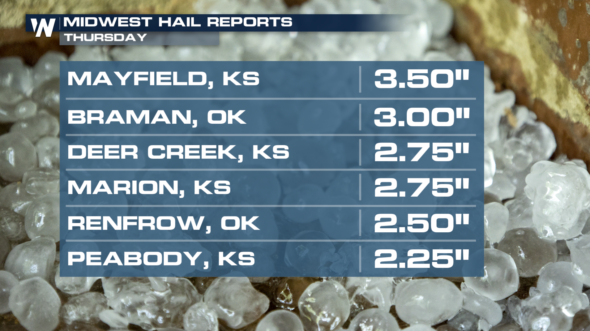 The Storm Prediction Center has issued an enhanced risk of severe weather on Thursday. The greatest threats will include very large hail and powerful wind gusts, but a few tornadoes are also a concern, especially in areas where storms can remain isolated and intensify. The severe threat continues into the overnight hours before gradually weakening!
Heavy rainfall may also accompany these storms, raising the risk of localized flooding in some areas already dealing with saturated ground. Residents across the Plains are being urged to stay weather-aware and have multiple ways to receive warnings, as conditions can change quickly during severe weather outbreaks.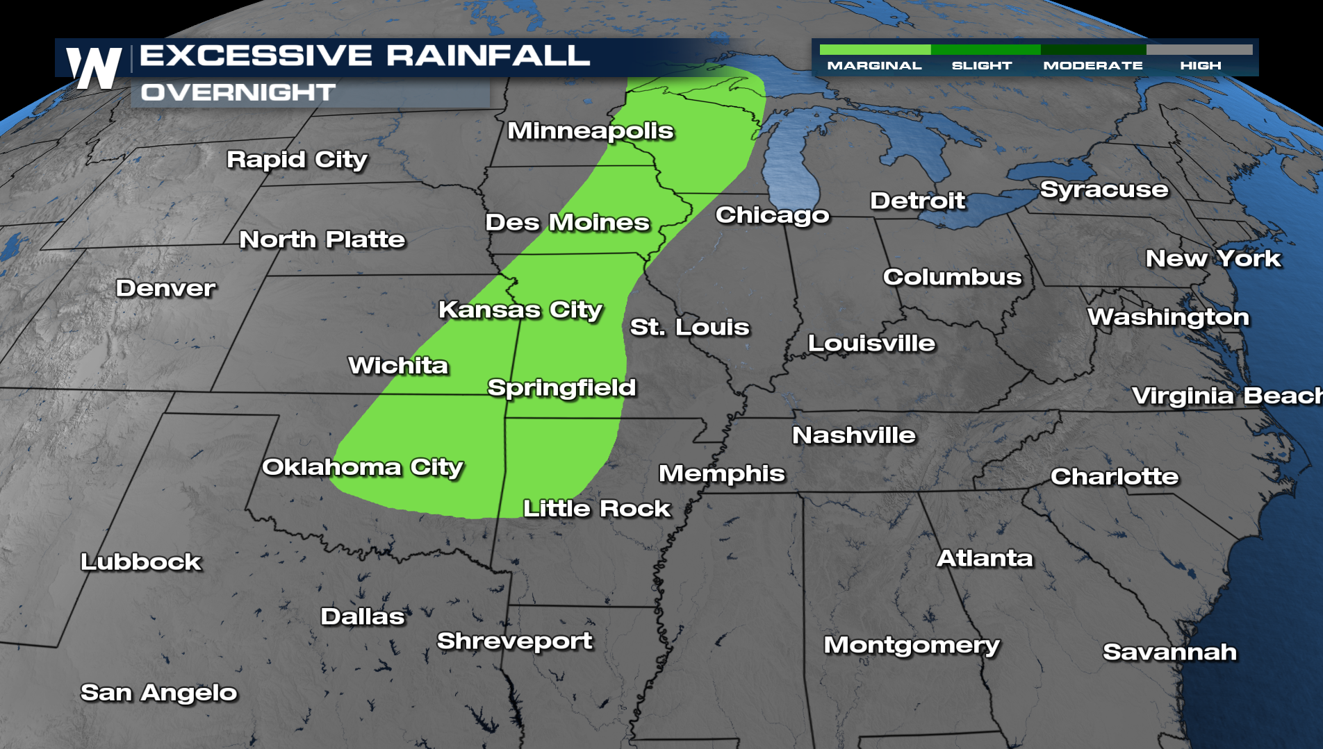
Tune into WeatherNation for more details.
All Weather News
More
Severe Threat Marches East This Afternoon
UPPER MIDWEST - Through Monday, dangerous tor
28 Jul 2026 4:25 PM

Tropics: Fausto Heads towards Hawaii; Genevieve Cat 4 Hurricane
PacificTropical Storm Fausto continues to tra
28 Jul 2026 4:20 PM


Southeast Flood Risk Lingers Near Stalled Front
A stalled boundary over the Southeast will ke
25 Jul 2026 10:55 AM

Another Round of Storms Targets the Northeast
Tuesday brought severe weather again across p
23 Jul 2026 1:15 AM

Another Round of Severe Weather for the Upper Midwest and Great Lakes
The upper-level low train continues to keep t
21 Jul 2026 1:45 AM